Abschlussarbeit
Photogrammetrische Rekonstruktion und Kartierung des Bergsturzes von Blatten im Jahr 2025
Details
- Extern/e Autor:in
- Simeon Schmauß
- Intern/e Betreuer:in
- Prof. Dr. Wilfried Hagg
- Abschluss
- Bachelor
- Studiengang
- GeoVisual Design - Geomatics
- Jahr
- 2026
- Fakultät
- Fakultät für Geoinformation
- Status
- abgeschlossen
- Themengruppe
- Geologie_Geographie
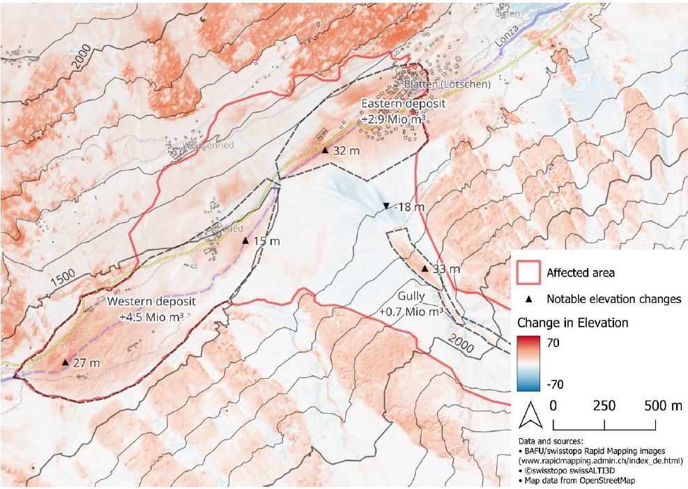
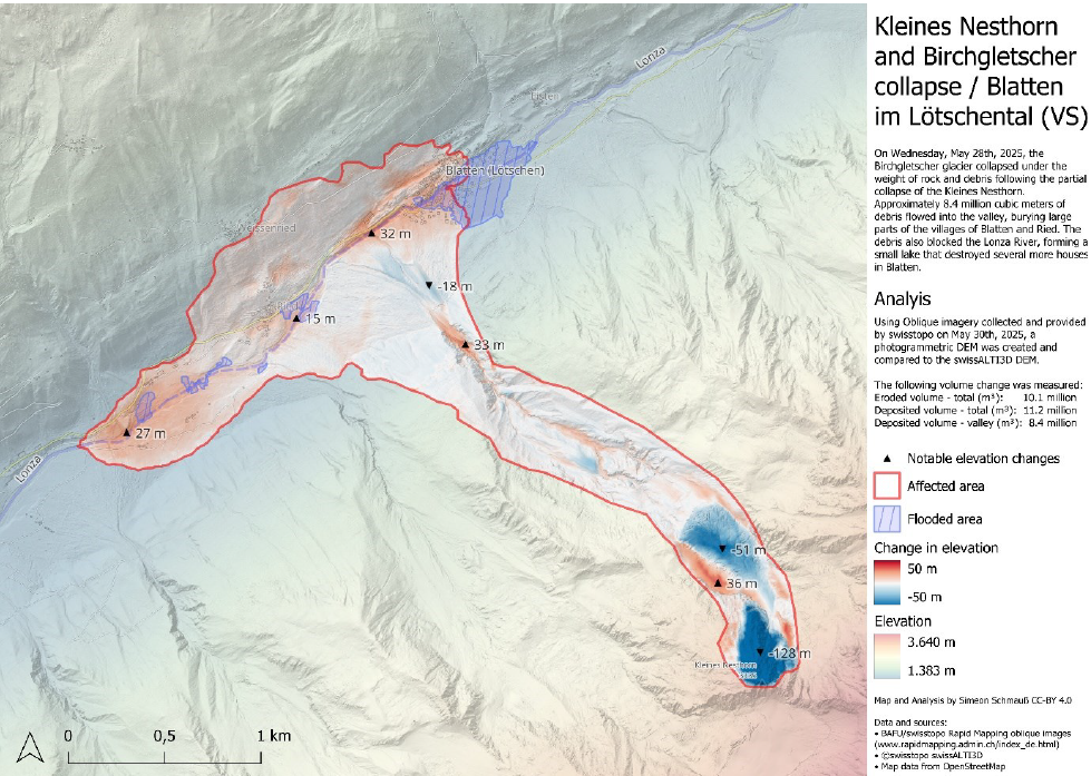
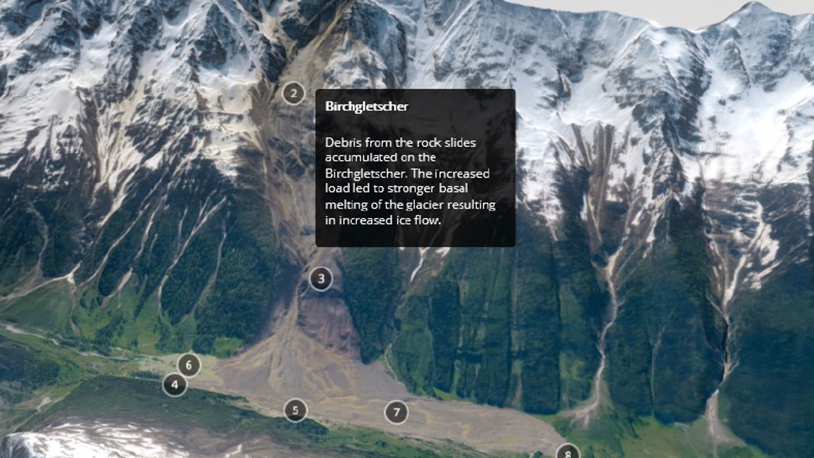
On 28 May 2025, a large rock-ice avalanche occurred above Blatten in the Lötschental, Switzerland, following the collapse of part of the Kleines Nesthorn and Birchgletscher. The event caused extensive erosion and deposition across the mountain slopes and valley floor. This thesis investigates the potential of rapidly acquired oblique aerial imagery to provide an early quantitative record of such large-scale geomorphic change.
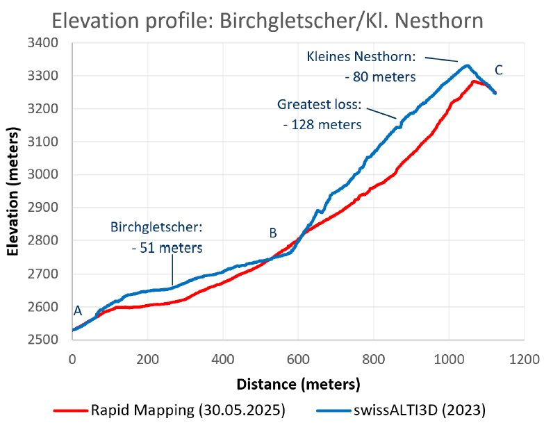
Aerial imagery acquired on 30 May 2025 as part of the Swiss Rapid Mapping programme was processed using a Structure-from-Motion photogrammetric workflow. Although the imagery was not specifically acquired for photogrammetric reconstruction and therefore presented limitations in camera positioning, image geometry, and ground control, it was used to generate a high-resolution orthophoto and digital elevation model of the affected area. The reconstructed topography was compared with the 2023 swissALTI3D terrain model and an independent post-event airborne LiDAR dataset acquired on 29 May 2025.
The accuracy assessment shows that local elevation differences can reach several meters, particularly in areas affected by horizontal misalignment, steep terrain, and reconstruction artefacts. Nevertheless, the integrated volumetric results show good agreement with the independent LiDAR reference. The photogrammetric reconstruction indicates approximately 10.1 million m³ of eroded material and 11.2 million m³ of deposited material, compared with approximately 9.7 million m³ and 10.8 million m³, respectively, in the LiDAR-based reference.
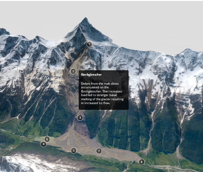
In addition to the quantitative analysis, the reconstructed data was used to produce an interactive 3D model and cartographic visualization of the event. The results demonstrate that rapidly available aerial imagery can provide useful early topographic information following a major geomorphic event, even when the source imagery is not optimized for photogrammetric surveying. While such products cannot replace dedicated high-accuracy post-event surveys, they can provide a valuable intermediate dataset for rapid documentation, quantitative analysis, and visualization before comprehensive reference data become available.